This post is a continuation of Photos from Back Roads, USA Part 2. It is the third and last of three sets of photos from that trip. A brief description of the trip can be found in Photos from Back Roads, USA Part 1. The detailed story appears in my book entitled, Motorcycling Stories – Adventure Touring from the Northwest Territories to the Yucatan Peninsula, along with 12 other trips that I took between 1977 and 2001. All photos shown in these postings are in chronological order. Photos from this part of the Back Roads, USA trip begin in southern Arizona the day after my wife Lillian left for home from Sky Harbor Airport in Phoenix and includes all of the photos that I took between then and the time I got home several days later.
 |
| Tucson, AZ area |
 |
West of Tucson, Arizona
|
 |
Kitt Peak National Observatory, Arizona (at top of mountain)
|
 |
Near Tombstone, Arizona
|
 |
Century Plant
|
 |
| Lavender Copper Mine (abandoned), near Bisbee, Arizona |
 |
| Copper extraction plant, Douglas, Arizona |
 |
Morenci open pit copper mine near Clifton, Arizona
|
 |
| Morenci mine |
 |
US Rte 666 (now called US 191), Gila National Forest, Arizona
|
 |
Petrified Forest National Park, Arizona
|
 |
| Petrified Forest |
 |
Painted Desert, Arizona
|
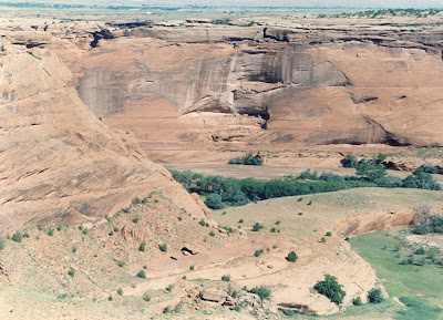 |
Canyon de Chelly National Park, Arizona
|
 |
Cliff dwelling at Canyon de Chelly
|
 |
Monument Valley, Utah
|
 |
| At Navajo Tribal Park in Monument Valley |
Mexican Hat, Utah
 |
Mexican Hat Navajo Reservation, Utah
|
 |
Near Bluff, Utah
|
 |
Oil pump near Bluff, Utah
|
 |
| Ute Indian Reservation, southwest Utah |
 |
Mesa Verde National Park, southwest Colorado
|
 |
Spruce Tree House, Mesa Verde
|
 |
Cliff Palace, Mesa Verde
|
 |
Mesa Verde National Park
|
 |
Mesa Verde National Park
|
 |
US Rte 550, north of Durango, Colorado
|
 |
Near Silverton, CO
|
 |
Abandoned gold mines near Red Mountain along Rte 550
|
 |
Ghost town near Independence Pass, Colorado
|
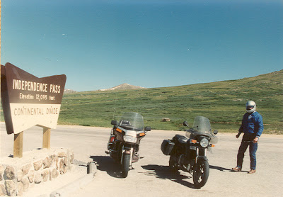 |
Independence Pass, Colorado, elevation 12,095 ft
|
 |
Near Independence Pass at 10,000 ft level
|
 |
Near Leadville, Colorado - 9,000 ft level
|
 |
North of Leadville
|
 |
Road to Guanella Pass (all gravel)
|
 |
Guanella Pass at 11,669 ft
|
 |
Pikes Peak summit at 14,110 ft.
|
 |
Pikes Peak access road (gravel at the higher levels)
|
 |
Royal Gorge Bridge
|
 |
Royal Gorge Bridge from foot of gorge. See the cable car?
|
 |
Railroad at foot of gorge. See the wooden water pipe?
|
 |
View of bridge from cable car.
|
 |
Scenic train ride at the foot of the gorge
|
 |
Better view of wooden water pipe
|
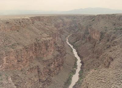 |
| Rio Grande River near Taos, New Mexico |
 |
Northern New Mexico
|
 |
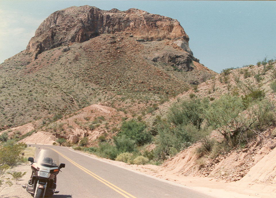
Near Fort Davis in southwest Texas
|
 |
Big Bend National Park, Texas - several scenes of Big Bend follow
|
 |
Santa Elena Canyon, Rio Grande Valley, Big Bend National Park
|
 |
Along Rio Grande on Farm-to-Market Road 170
|
 |
Abandoned farm along the Rio Grande
|
 |
Delaware Basin oil field in Texas
|
 |
Abandoned dirt farm, Oklahoma
|
 |
Along Talimena Skyline Drive (in fog), eastern Oklahoma
|
 |
Dorena Ferry across the Mississippi River
|
 |
Arriving on Dorena, Missouri side of river
|
 |
Not much of a town at the west side of the river
|
 |
Leaving the west side
|
 |
The east shore landing, coming up
|
 |
Landed at Hickman, Kentucky, and no one is waiting.
|
 |
Tobacco farm in Tennessee
|
 |
County Road 700, Benhams, Virginia
|
 |
Virginia Rte 42, near Bradford
|
 |
The House Restaurant, Bland, Virginia (was a favorite stop)
|
 |
County Rd 730 near Eggleston, Virginia
|
 |
| VA Rte 42 near Newport, Virginia |
 |
Sinking Creek, Virginia
|
 |
Farm in West Virginia
|
 |
Grand Cacapon Valley, Potomac River, West Virginia
|
 |
South central Pennsylvania
|
 |
East of the Bear Mountain Bridge, New York, 6 miles from home.
|


No comments:
Post a Comment